
Graphing my way across the USA!
Jul 28, 2013 travel
I’ve been planning a trip around the United States for the past few weeks. I’ve got my bag, my clothes, my documents and even my portable bucket. Now all I need is… an itinerary? Rats!
Since this trip is intended to be a preliminary journey before I head off to more distant lands, I want to take most of it by train. It’ll be nice to see a fairly sizable portion of the country from the window. I might end up regretting it when I’m sitting in a 48-hour Amtrak car that’s delayed in the middle of the boonies, but hey, it’s better than refreshing MetaFilter or Hacker News for hours at a time.
I drew up my initial plan a few hours ago. Seeing as how I didn’t want to meticulously plan every detail of my drip ahead of time, I decided that a flow chart would be the best way to do it. (It’s like a choose your own adventure book in real life!) The best online tool I could find for this purpose was called LucidChart, by virtue of the fact that it featured automatic curved arrows. Free for personal use! Really cool.
Here’s the semi-finished map (click for larger):
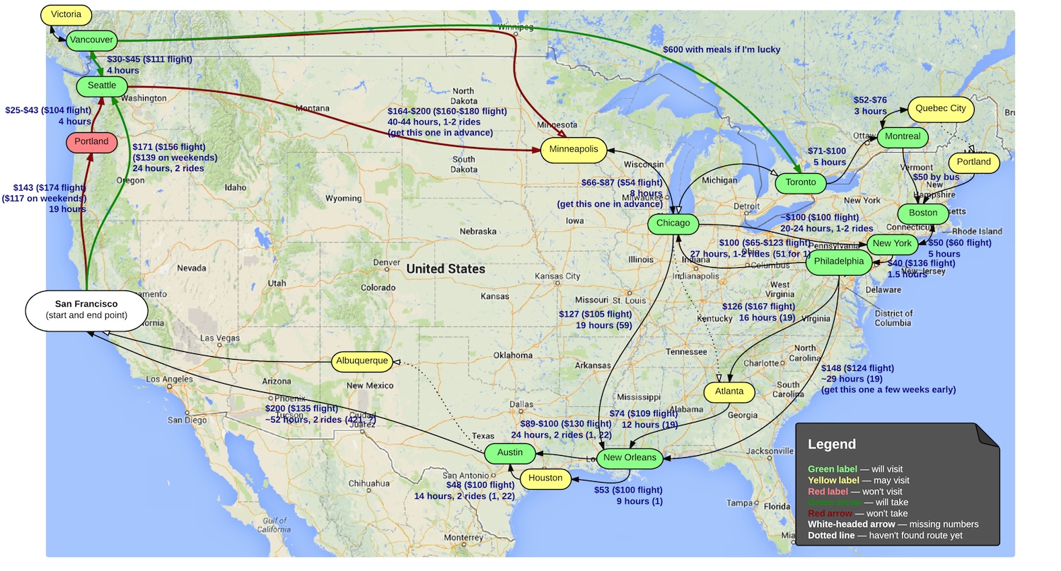
That Vancouver to Toronto route looks particularly tempting. If I can snag a good deal on a ticket, I’d love to go San Francisco → Portland (?) → Seattle → Vancouver → Victoria (?) → Toronto → Montreal → Quebec City → Boston → New York → Philadelphia → Chicago → Minneapolis → New Orleans → Houston (?) → Austin → San Francisco. Otherwise, I’ll have to go from Seattle to Minneapolis and probably go to Toronto from Chicago. Either way, should be tons of fun! I’ll be sure to take lots of photos.
—Archagon
July 28, 2013